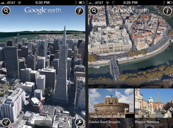
Ahead of iOS 6’s release and Apple’s new Maps application, which includes photo-realistic interactive 3D views with Flyover, Google has updated their Google Earth application for iOS, bringing 3D views to Apple’s most recent iPhones and iPads. Google’s 3D views are automatically rendered when you pinch into supported towns and cities — tilting your perspective will let you rotate about building model and get a sense of placement that flat satellite imagery simply can’t provide. The transition from a flat satellite image to 3D models is quite seamless, although rending those 3D models did put a lot of strain on my iPhone 4S, where I received a “memory low” error via an alert before the app crashed. Viewing your locale in 3D is nifty, at least while Google Earth cooperates. Funnily enough, Kansas City has yet to receive a 3D render of the city, despite today’s announcement of availability for Google Fiber.
Also in today’s update is a brand new tour guide that suggests places you might not otherwise search out, guiding you to explore suggested landmarks and natural wonders from your iOS devices. I found that while this feature is nice to have on the iPhone, it really makes sense on the iPad, where you have the larger screen real-estate to zoom and pinch around maps.
Google Earth is a free download from the App Store.
[via MacRumors]


