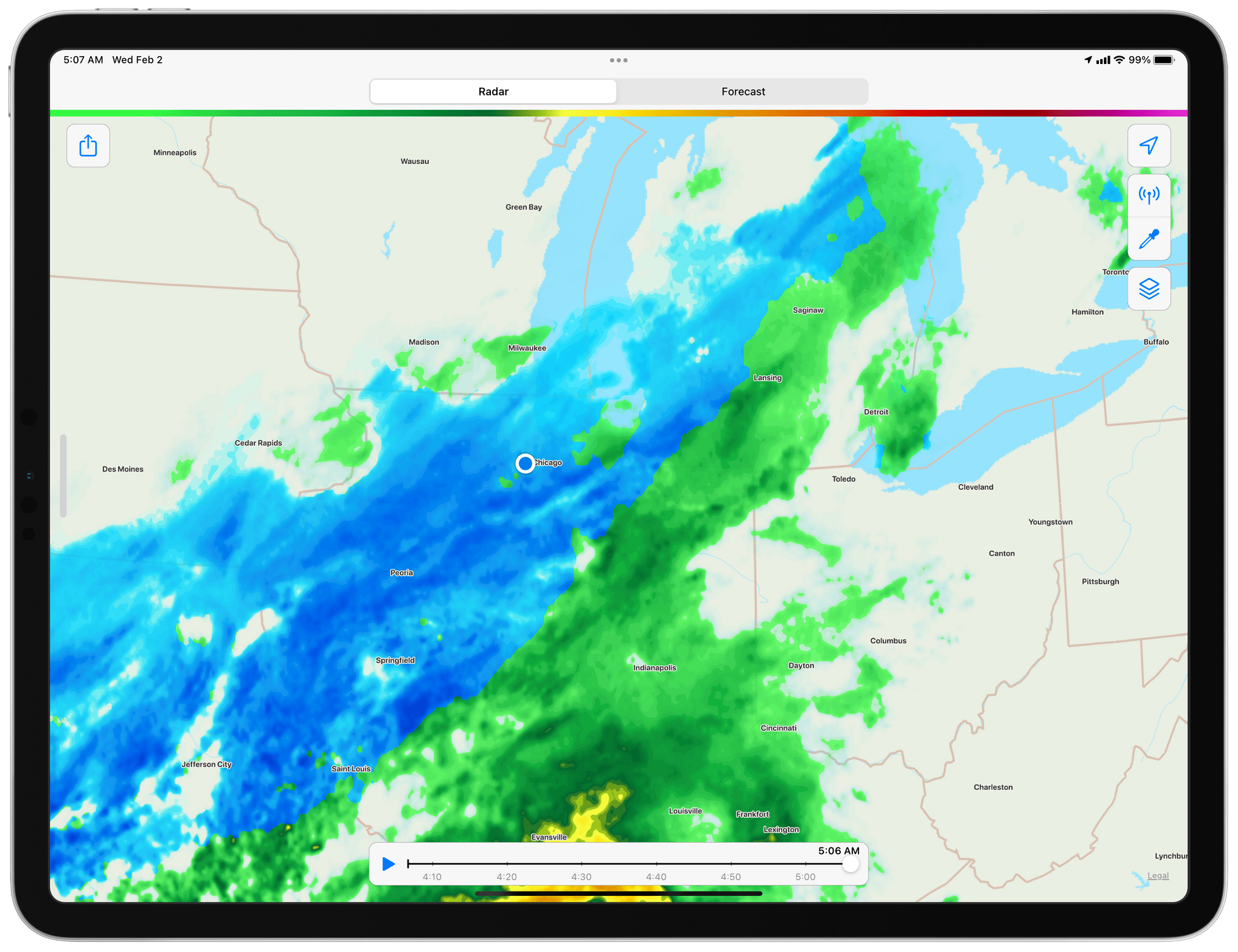
CARROT Weather 5.5 is out with a focus on weather maps. The entire maps UI has been redesigned and expanded with the same sort of deep customization options found throughout the rest of the app. It’s an excellent update that’s all about visual design, so get ready for a bunch of screenshots.
The app’s precipitation map, which opens by default the first time you open the maps feature, includes a toggle at the top of the screen for switching between the current conditions and a forecast of the next several hours. There’s a new eyedropper button on the map that activates the Inspector tool too. Tap it, and crosshairs appear in the center of the map view, along with the current rate of precipitation at that location, which updates as you drag the map around under the crosshairs. With the Inspector tool, you can very quickly get a sense of things like precipitation rates for an approaching storm.
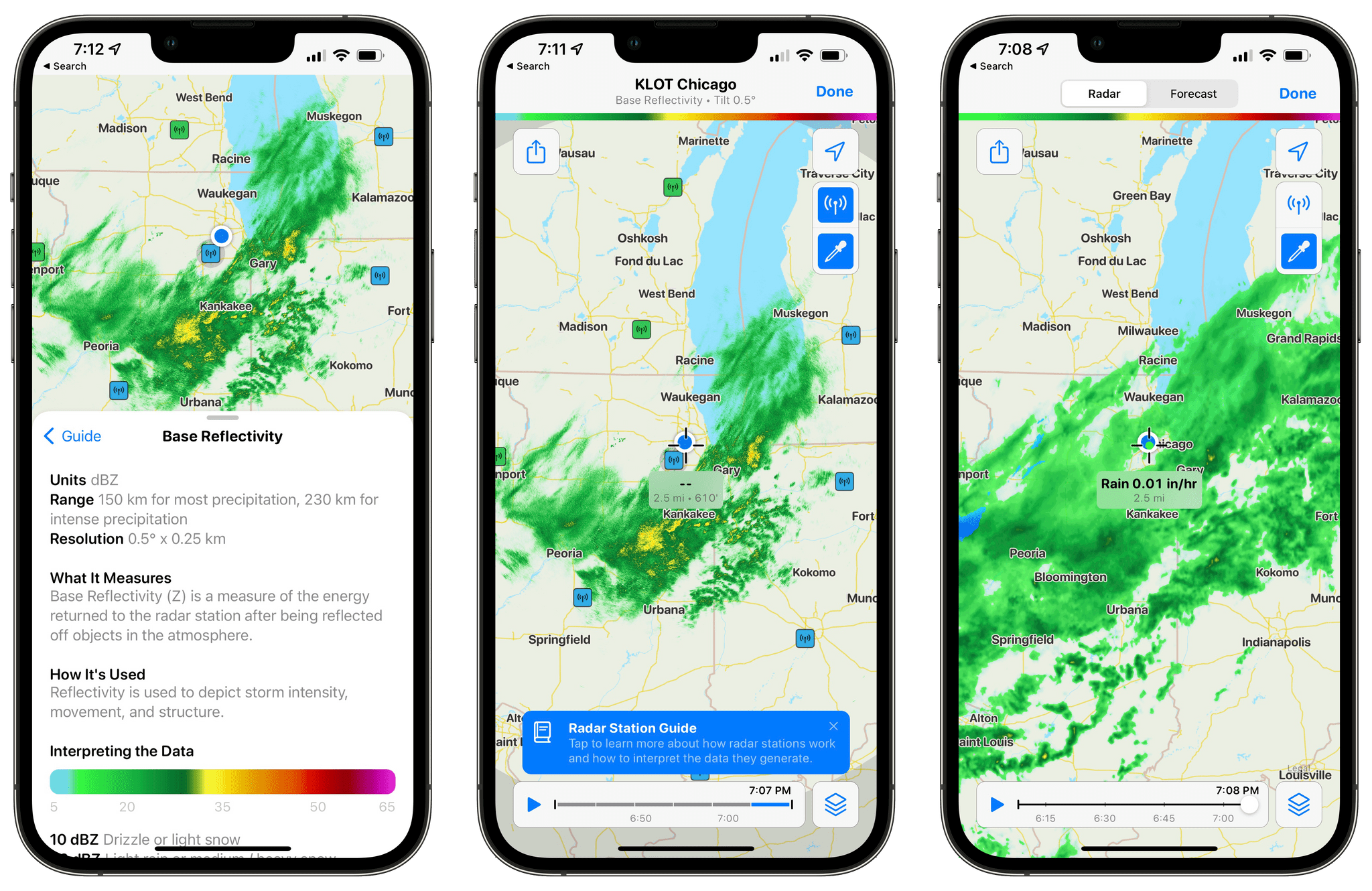
CARROT Weather 5.5 includes data from individual radar stations, a guide to understanding their data, and an Inspector tool for precise location-based measurements.
If you want to see the readings from individual weather radar stations, tap the radio transmitter button on the map. As you tap on radars on the map, you’ll get a view of what that station is reporting. Fortunately, developer Brian Mueller has also included an in-app guide to explain how the stations work and how to interpret the data.
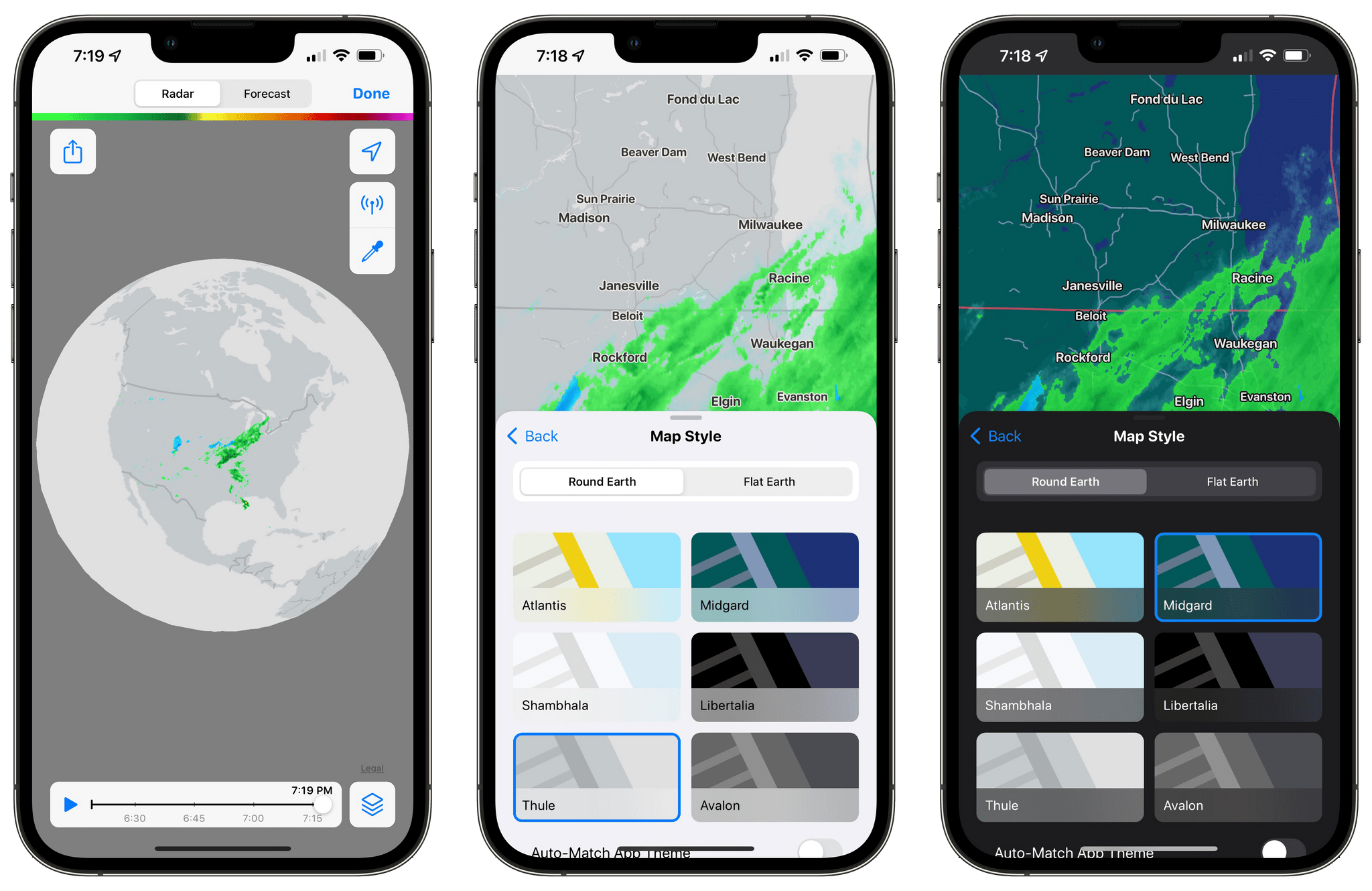
There are a total of three map styles to choose from: three light and three dark themes that can be displayed on a round or flat Earth. Picking the round option and zooming out will give you a bird’s eye view of the entire globe, while the flat option is a projection-style 2D map.
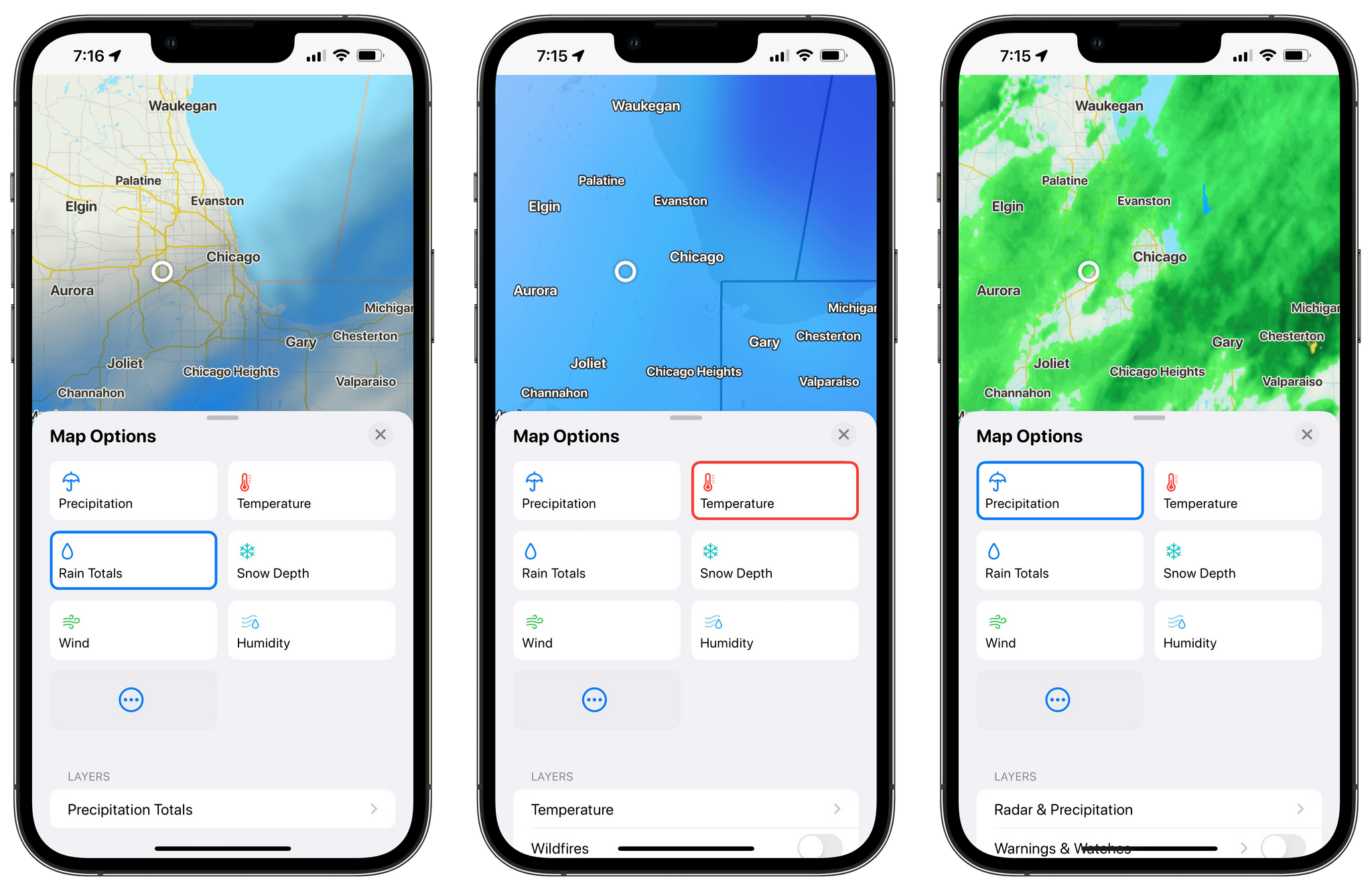
In addition to the precipitation map, CARROT Weather can display five other maps that can be accessed using the Map Options button in the lower right-hand corner of an iPhone’s screen, including:
- Temperature
- Rain Totals
- Snow Depth
- Wind
- Humidity
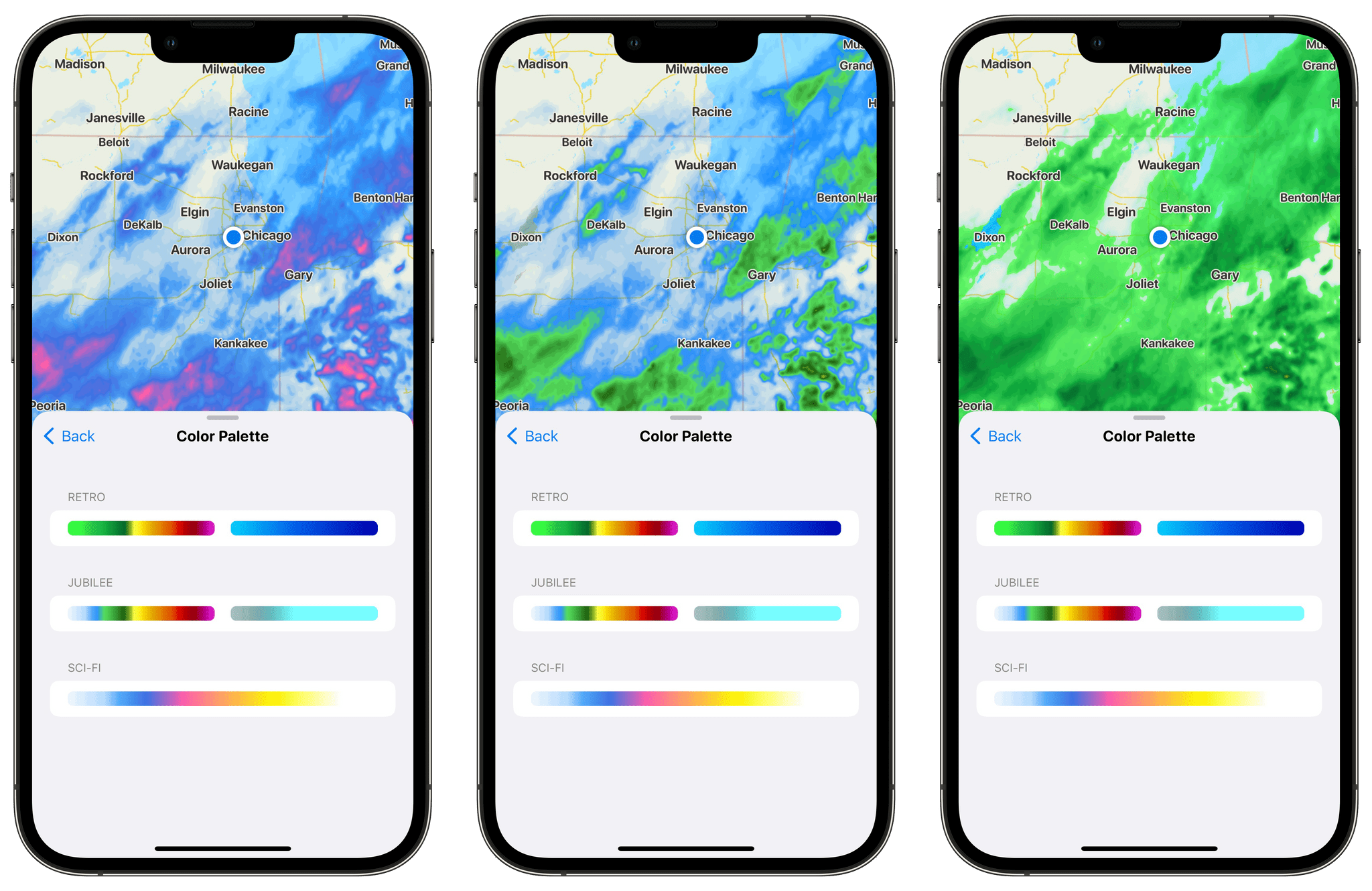
Each map supports multiple layers of additional data that vary depending on the map. For example, the Precipitation map has layers for radar and precipitation, weather warnings and watches, storm cells, lightning strikes, tropical storms, cloud cover, and pressure fronts. The other layers also support the Inspector tool. The opacity of layers can be adjusted, and for the Precipitation map, three different color palettes are available. The maps can also be added to your Home Screen in small, medium, and large sizes on the iPhone, plus extra-large on the iPad.
As I write this, a potentially significant snowstorm is bearing down on the Chicago area where I live. Winter Weather Alerts have been issued, schools have been preemptively closed, and I’m queuing up some podcasts to listen to as I dig out tomorrow after I publish this. The timing couldn’t be better to test CARROT Weather’s maps, which have been impressive. The maps load quickly, the animations are smoother than ever, and combined with the Inspector tool, it’s easy to quickly get a sense of how soon a storm will arrive at your location and how much rain or snow it will dump on you.
Most of the map layers are part of the CARROT Weather Premium subscription, while individual radar stations, the Inspector tool, and the weather map widgets are included with a Premium Ultra subscription. CARROT Weather 5.5 is available to download from the App Store.


