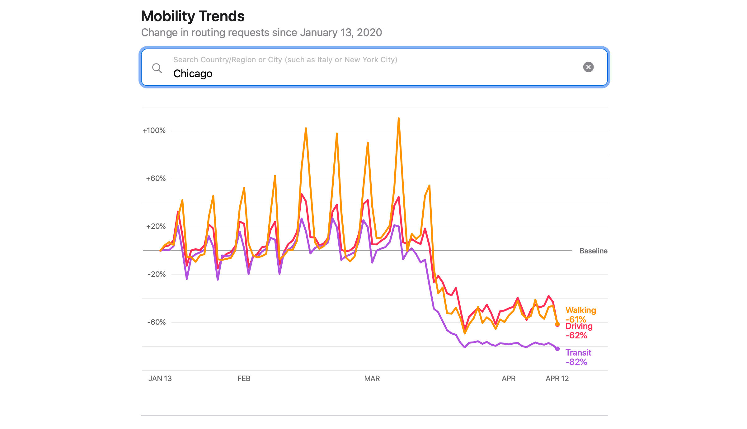
Apple has shared a new web-based tool that provides insights from Apple Maps on mobility trends. According to Apple’s press release:
This mobility data may provide helpful insights to local governments and health authorities and may also be used as a foundation for new public policies by showing the change in volume of people driving, walking or taking public transit in their communities.
The tool can be found at apple.com/covid19/mobility, where you can view driving, walking, and transit trends for 63 countries as well as major cities around the world. Apple’s press release also explains how the data is collected and addresses privacy:
Maps does not associate mobility data with a user’s Apple ID, and Apple does not keep a history of where a user has been. Using aggregated data collected from Apple Maps, the new website indicates mobility trends for major cities and 63 countries or regions. The information is generated by counting the number of requests made to Apple Maps for directions. The data sets are then compared to reflect a change in volume of people driving, walking or taking public transit around the world. Data availability in a particular city, country, or region is subject to a number of factors, including minimum thresholds for direction requests made per day.
Having tried the tool, it’s fascinating to see the differences between the effect of mobility restrictions around the world. I’m glad to see Apple sharing this information on an aggregate, privacy-conscious way that hopefully can help governments and health organizations around the world assess the effectiveness of measures put in place to slow the spread of COVID-19.


