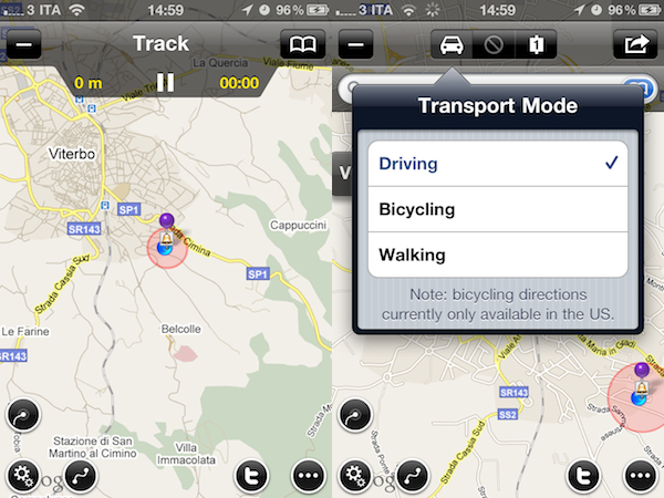
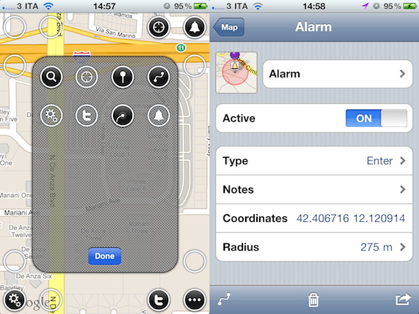
Maps+ by IZE, released earlier today in the App Store for iPhone and iPad, is a new free application that aims at enhancing the standard iOS map experience by plugging directly into Google Maps and adding several new features and interface improvements that turn the mapping software into a powerful location and social sharing tool. Maps+ supports Google Maps’ standard views (standard, satellite, hybrid, terrain) and allows you to quickly switch between them with a vertical three-finger swipe that may result unintuitive on the iPhone, but works really well on the iPad. What impressed me about Maps+ upon first launch is the way the app lets you customize the buttons that will overlay the standard map. From a translucent editing interface, you can drag buttons (settings, alarms, fetch position, Twitter, route and track) onto the map in pre-selected spots running along the top and the corners of the map screen.
Maps+ can get your current position, as well as search for specific addresses. Once you’ve found an address on Google Map, Maps+ can get you there with directions for driving, walking and bicycling (the selection happens from an iPad-like popover menu), give you different routes and check out the destination point in greater detail from a dedicated screen. Here, you can choose to “route here” or “drop pin”, add the place to your bookmarks, copy or mail the link and even export to GPX for viewing this information on your computer or other compatible apps. There’s more: you can use location-based alarms to be notified when you hit a place of particular interest and, if your device supports multitasking, alarm monitoring and (another feature of Maps) GPS track recording will work in the background. Among all the little additions to Google Maps and the functionalities you can check in the full app description on iTunes, one that really surprised me is Twitter integration within maps: thanks to Twitter’s geolocation support, once logged in with Maps+ you’ll be able to see your friends and people you follow on a Map, see who replied to you and where and even report spammers from Maps+. The developers describe it as a complete Twitter client, only displayed on a map.
Maps+ is free, but some features need to be unlocked at $2.99 via in-app purchase. Here’s what you get with the free edition:
- Labels are limited to 1.
- Pin bookmarks are limited to 3.
- Route bookmarks are limited to 1.
- Route transit points are limited to 2.
- Track bookmarks are limited to 1.
- Track recording is limited to 2 km.
- Alarm bookmarks are limited to 1.
- Importing bookmarks from GPX is disabled.
- Logging in to Twitter is disabled.
If you’re serious about maps on your iOS device, forget the Google Maps webapp and Apple’s own application and go get Maps+ now. It’s powerful, well-designed, easy to use and Twitter integration adds a lot of value, and a welcome social aspect.


