Posts tagged with "maps"

Pedometer 5.0 Update Adds Map-Based Workouts, Live Activities, Accessibility Improvements, and Apple Watch Ultra Integration

David Smith announced the release of Pedometer++ 5.0 today, and it looks like a big one. Smith says 5.0 has been rewritten from the ground up using SwiftUI and includes:

  • Dynamic Type support
  • Workout tracking, which was previously Watch-only, is now available on the iPhone too
  • Live Activities that display distance and duration data or a map and distance preview are available in multiple styles
  • Map-based routes can be added by transferring GPX files to the iPhone app using the iOS share sheet, which then syncs them to your Apple Watch
  • Saved and favorite routes can be added to the Apple Watch too
  • Once on the Watch, routes can be used in a new maps-based workout tracking mode, which displays them live
  • The Apple Watch Ultra’s Action button can be used to start a walk quickly or to switch between map and metric views in the Watch app

I’m looking forward to giving this update a try. I’ve enjoyed using Footpath’s map integration as I explore North Carolina, and I’m curious to see how the apps compare.

Pedometer++ 5.0 is available as a free download on the App Store. Some features, including workouts, require a subscription.

Permalink

Mapper Safari Extension Automatically Redirects Google Maps Links to Apple Maps

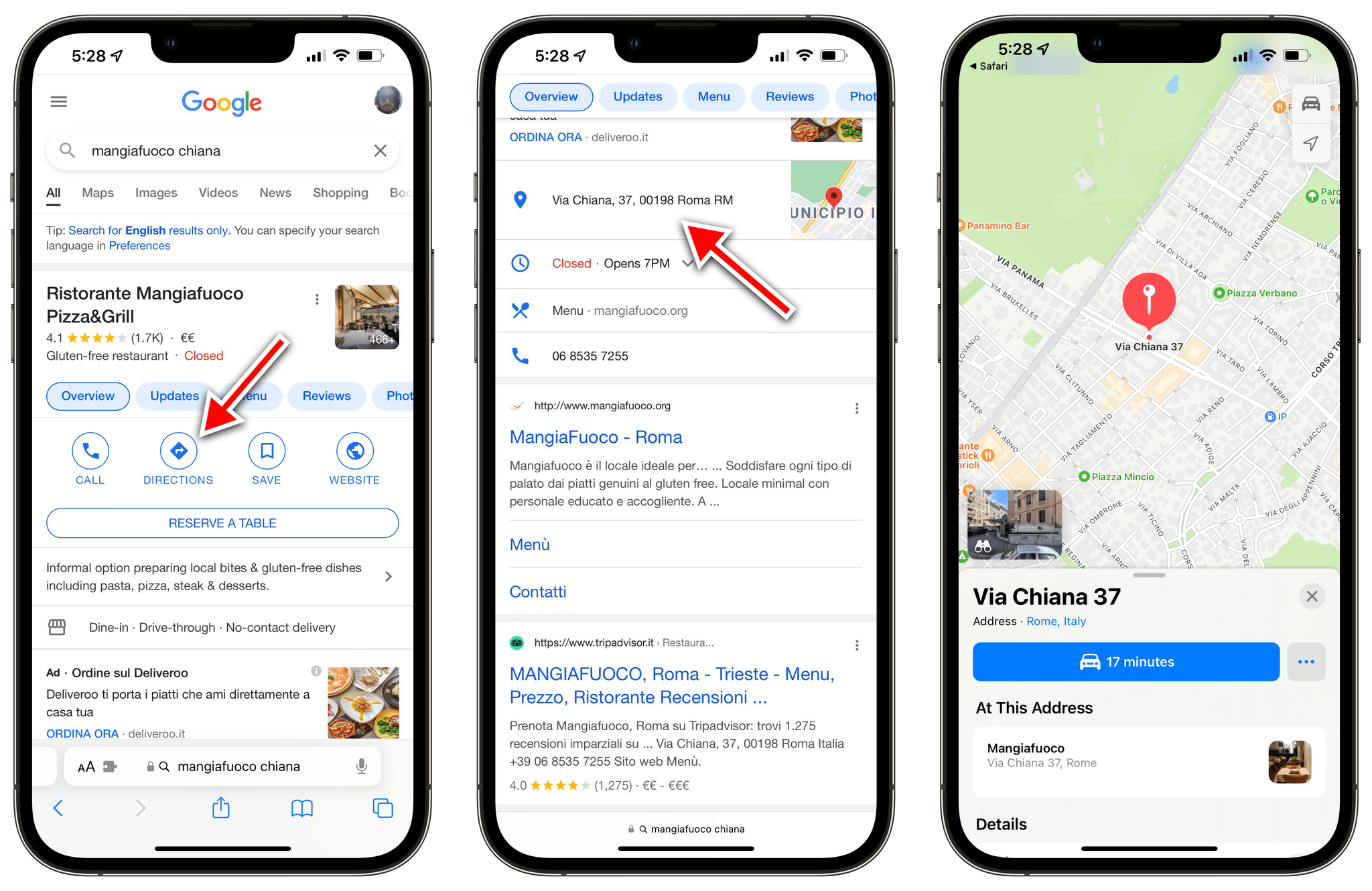
All of these place links get redirected to Apple Maps with Mapper.

All of these place links get redirected to Apple Maps with Mapper.

Ever since Apple rolled out the redesigned and improved Apple Maps in Italy last month, I’ve been increasingly switching my usage of maps for exploration and turn-by-turn directions from Google to Apple Maps. I prefer Apple’s overall design sensibilities, I find Look Around drastically superior to Google Street View, and the integration with Apple Maps and the Lock Screen for turn-by-turn navigation is excellent.

However, I still have to keep Google Maps installed on my iPhone for all those times when a particular point of interest (usually a shop or restaurant) isn’t showing up in Apple Maps’ search results. And because the Google Maps app is still installed on my iPhone, every time I tap a search result with an address from Google search, it automatically redirects to Google Maps. I’ve always found this annoying, but now even more so since I consider Apple Maps my primary navigation app here in Rome.1 Now, thanks to a Safari extension, that Google Maps redirect nightmare is finally over.

Read more


Maps Adds Accident, Hazard, and Speed Check Reporting Using the iPhone, CarPlay, and Siri to the iOS 14.5 Beta

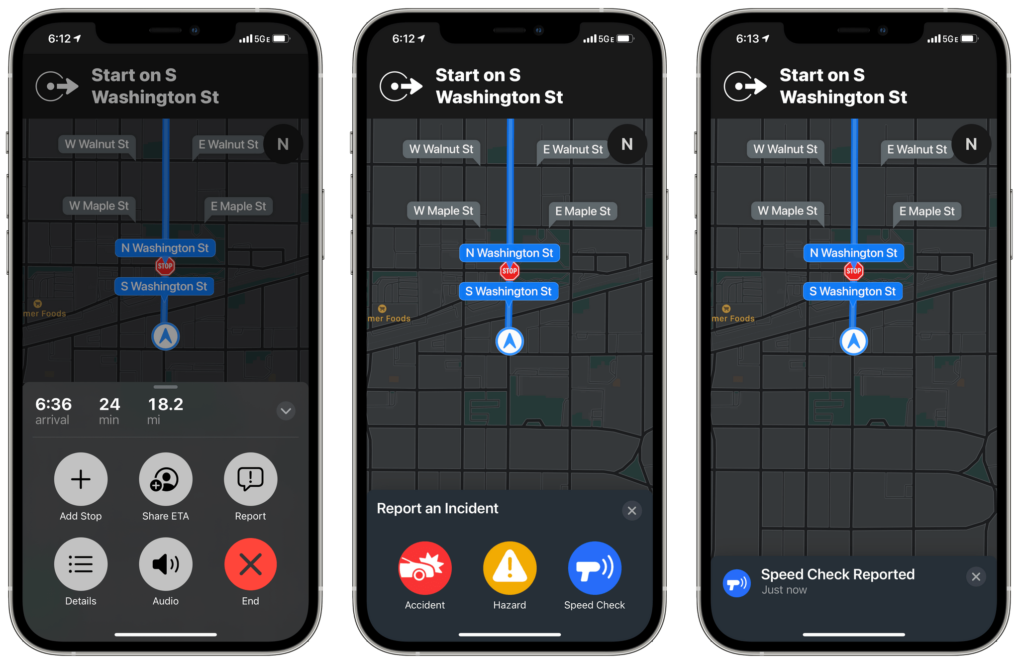
Apple has rolled out another new feature to iOS 14.5 beta testers in the US: accident, hazard, and speed check reporting in Maps.

The new feature, which appeared today, is available once you begin navigating to a destination using Maps on your iPhone or via CarPlay. After you tap the ‘Go’ button, you can tap or swipe up from the bottom of the Maps app on your iPhone or tap the new ‘Report’ button on the right side of the CarPlay UI to reveal options to report traffic accidents, road hazards, or speed checks. All three alerts can be reported and cleared using Siri too.

Submitting a report using CarPlay

Submitting a report using CarPlay

I did some preliminary testing of the feature using Maps with my iPhone, CarPlay, and Siri, and it worked well without any issues. My one quibble is with the placement of the Report button in CarPlay. It’s quite small and on the far side of the screen from the driver. You can use Siri to send a report instead, but I expected the Report button to be revealed when I tapped on the strip along the bottom of CarPlay’s Maps view that lists information like the estimated arrival time at your destination.

It will probably be a while before enough people are using iOS 14.5 for accident, hazard, and speed check alerts to begin popping up as I drive somewhere. However, there are enough other big features coming in 14.5, like the Face ID plus Apple Watch iPhone unlocking when you’re wearing a face mask, that I expect we’ll begin to see notifications pop up in Maps once iOS 14.5 is officially released.


Apple Maps’ Northeast Expansion Visualized

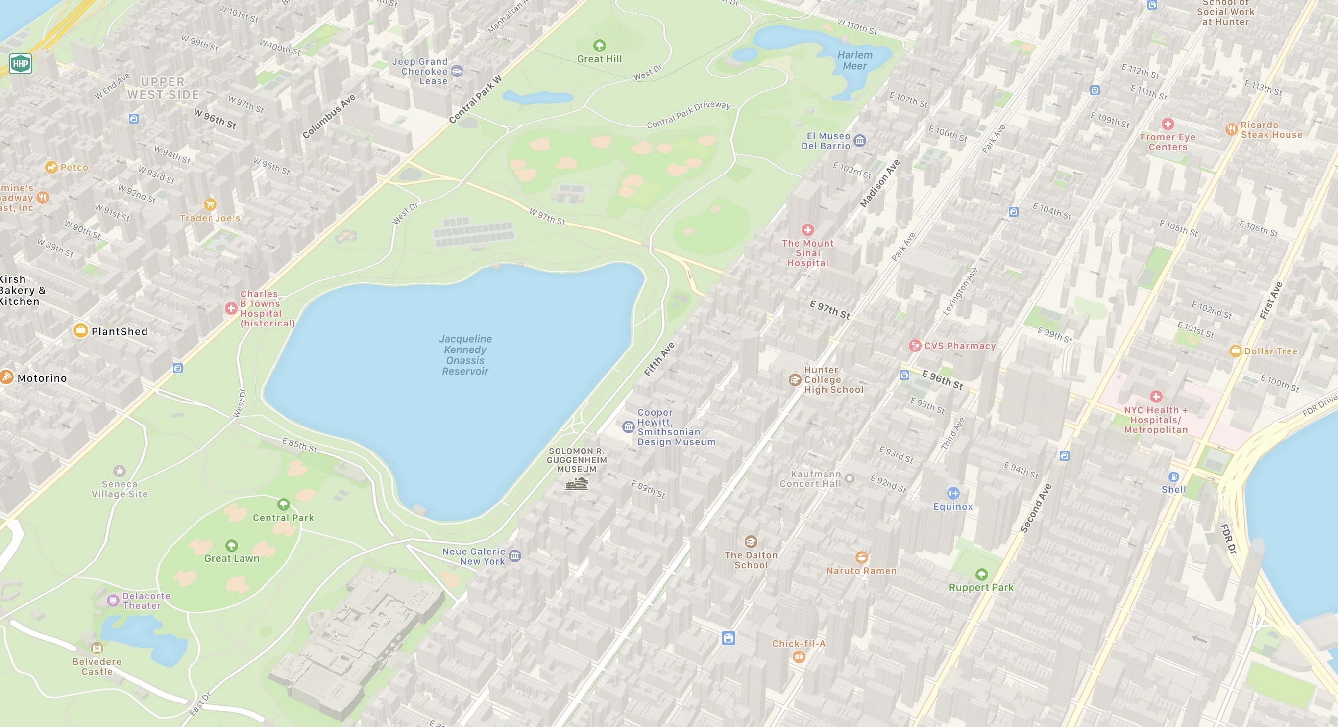
Yesterday Apple began the full rollout of its new maps for the Northeastern United States. And right on the heels of that release, Justin O’Beirne has meticulously documented and compared Apple’s new work with the mapping data that it replaces. He begins by highlighting Apple’s progress toward launching its new maps throughout the U.S.:

With this latest expansion, Apple’s new map now covers 27.5% of the U.S.’s land area and almost half of its population (47.2%).

Apple has promised that its new maps would be available to all U.S. users by the end of 2019, so the rollout – which began last September with iOS 12 – will need to significantly accelerate from now through December.

The bulk of O’Beirne’s post lets the new maps speak for themselves. Pulling from significant locations all throughout the Northeast, O’Beirne showcases direct comparisons between the old and new maps. As has been seen in other parts of the U.S., Apple’s new maps feature significant expansions of vegetation, new details for features like ball fields and small parks and rivers, and even road enhancements. Apple’s Look Around feature, which competes with Google Street View, is also now available in some of these Northeastern locations, such as in New York City.

Maps in iOS 13 is a big update, particularly if you’re in an area that has the new Apple-designed maps. I’m excited to have the new maps arrive in New York City, and look forward to getting some hands-on time with them over the coming weeks.

Permalink

DuckDuckGo Switches to Apple Maps for Location Searches

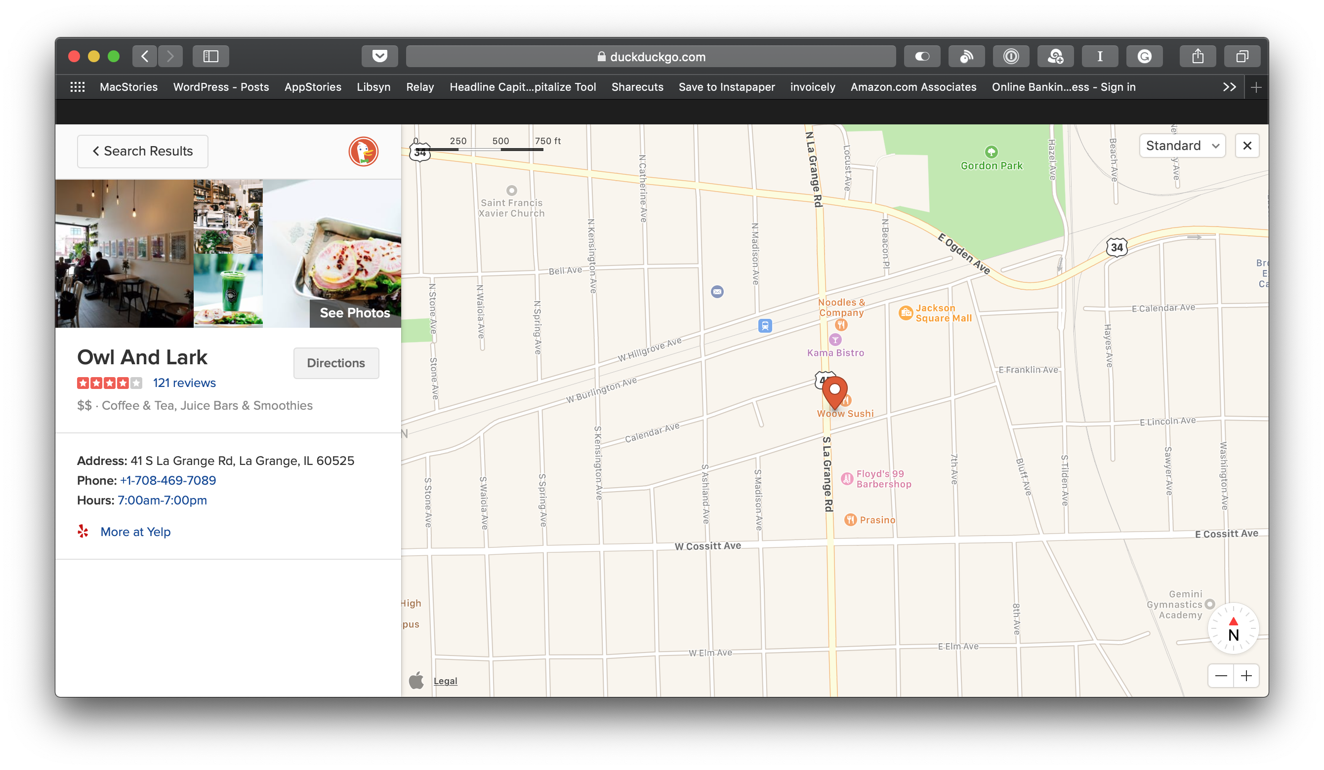
Today, DuckDuckGo, the privacy-focused web search engine, began using Apple Maps for location-based searches. The company, which previously used OpenStreetMap, switched to Apple’s MapKit JS framework, which Apple introduced at WWDC in June 2018.

General search results and DuckDuckGo’s Maps tab both embed Apple Maps’ familiar UI with options to display street, satellite, and hybrid views of locations combined with Yelp data for businesses and other destinations. According to DuckDuckGo, users can search by address, geographical place, business name and type, and nearby. Clicking or tapping on the map preview in search results expands the map while selecting a location highlights it on the map.

With respect to location tracking, DuckDuckGo says:

At DuckDuckGo, we believe getting the privacy you deserve online should be as simple as closing the blinds. Naturally, our strict privacy policy of not collecting or sharing any personal information extends to this integration. We do not send any personally identifiable information such as IP address to Apple or other third parties.

DuckDuckGo explains elsewhere on its site that it uses GEO::IP lookup to determine users’ location by default. For better results, users can grant DuckDuckGo permission to use their browser location data, in which case DuckDuckGo says searches are still anonymous because the company does not store location data on its servers.

I tried DuckDuckGo’s new Apple Maps integration with several different searches. The search engine had no problem finding the coffee shop I was at this morning, and the familiar Apple Maps UI is a definite plus. However, the results weren’t as good when I ran a few ‘near me’ searches. Searches for coffee, pizza, and barbers ‘near me’ all returned better results before I granted DuckDuckGo access to my location. Of course, these are just a few non-scientific searches from one location, so your results may be different.


Waze Adds CarPlay Support

Today, Waze, which is owned by Google, updated its iOS app with CarPlay support, which Google Maps received last week. I took Waze out for a few errands over lunch and in my limited testing was impressed.

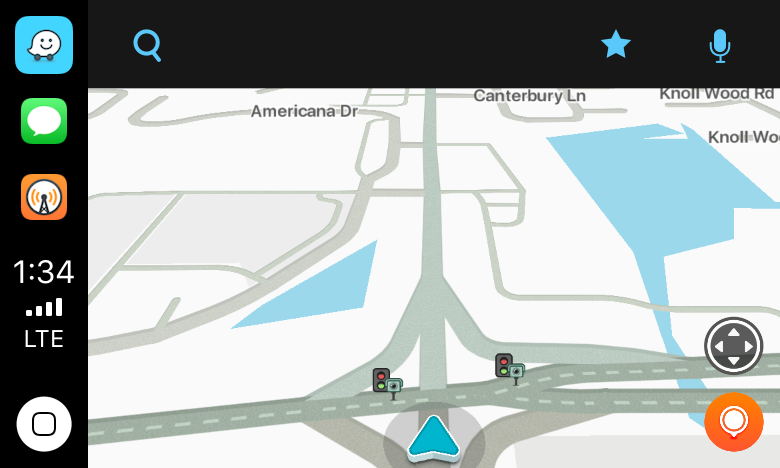
Waze immediately identified nearby stoplight cameras.

Waze immediately identified nearby stoplight cameras.

The first stop was the bank to pick up some cash. As I passed through a busy intersection, Waze warned me that there were stoplight cameras ahead, which I knew about, but it was good to see Waze did too.

I'm glad I missed that sheet of plywood in the road.

I’m glad I missed that sheet of plywood in the road.

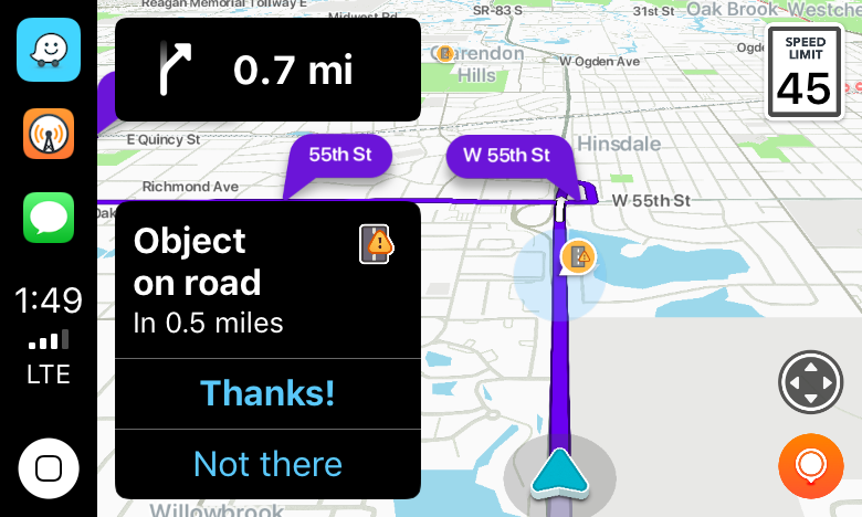
Next, it was off for some steak tacos to celebrate finally finishing my Mojave review. On the way, Waze said there was an object in the road. Sure enough, there was a piece of plywood straddling two lanes not too far ahead. Waze also alerted me to heavy traffic just ahead of my turnoff.

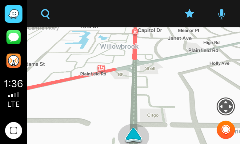
Waze alerted me to local road work.

Waze alerted me to local road work.

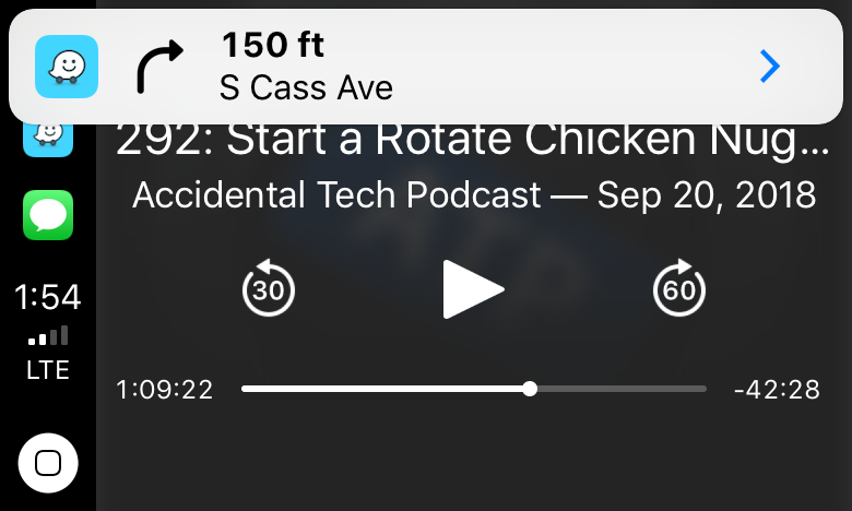
With each alert, the CarPlay UI displayed a notification with two choices: ‘Thanks!” and ‘Not there,’ with big buttons to allow me to help train the Waze database. I flipped back to Overcast, and as I approached my next turn, Waze announced it, momentarily pausing the audio, and displayed a notification that I could tap to return to the map of my route.

Tapping the Waze notification takes you back to the map view.

Tapping the Waze notification takes you back to the map view.

For people who use Waze regularly, those sorts of alerts and notifications will be familiar. Apple Maps still has the advantage of Siri integration with the hardware buttons on my steering wheel because like Google Maps, Waze can’t access Siri. That’s a shame because it’s easier to press a dedicated steering wheel button than it is to poke at a CarPlay screen in the center of your dashboard to do a voice search, but from a parked position in a bank parking lot the voice command I gave it was recognized immediately and I was on my way to the correct location.

I’ve only used Waze for this one trip, but my first impression was that the app is solid and should be well-received by its users. Especially for commuters that want traffic and other real-time, crowd-sourced data, Waze is a great option.

Waze is available as a free download on the App Store.


Streets 4 Adds Drag and Drop, Live Panorama Mode, and iPhone X Support

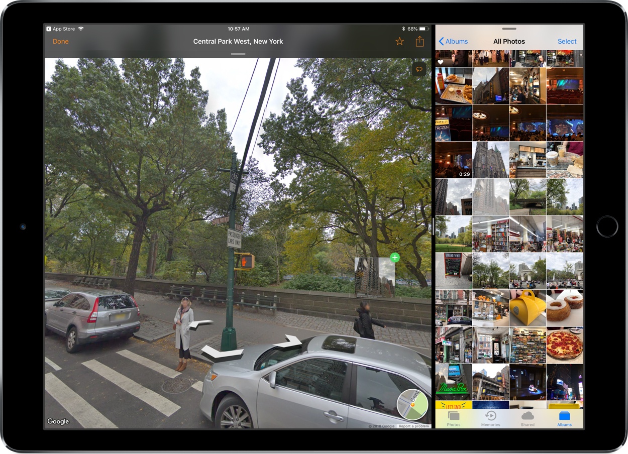
Last week my wife and I ventured to New York City for a vacation, and in the time leading up to that we planned out our agenda with the help of Google Street View. Unfortunately, our planning took place just a couple weeks too early to benefit from the newly released Streets 4 by FutureTap.

Streets is an iOS and watchOS app John reviewed upon version 3’s release. It provides an immersive, touch-friendly way to navigate Google’s Street View data. And in version 4, that experience has been upgraded with drag and drop support on iPad, a new Live Panorama mode, and optimization for the iPhone X’s display.

Drag and drop enables you to drop in a location from Apple Maps, a contact that includes an address, or any other linked address to load up nearby panoramas in Streets. My favorite feature enables dropping in any geotagged photo, which Streets will identify the location of so it can show you existing 360º images of the same or a nearby area – an easy way to discover great captures from other photographers.

Live Panorama mode can be toggled on by tapping the rotating circle icon in the top-right corner. Once activated, it offers a new interaction method for exploring street views. Rather than swiping around on the screen, simply move your device in the space around you and the visible street view area will change with your motion.

Whether you’re planning some time away, or simply want to explore the world from the comfort of your couch, Streets is the best way to do so on iOS.

Streets 4 is available on the App Store.


A Year-Long Experiment Comparing the Best Map Navigation Services

We all have our own anecdotal reasons for thinking a certain map navigation service is best, but few of us are willing to perform a committed experiment that gathers enough data to prove our beliefs. Artur Grabowski, however, did just that.

In an experiment that began early last year and led to recording 120 different driving trips, Grabowski compared the big three mapping services: Apple Maps, Google Maps, and Waze. Though more complex studies could certainly be done, Grabowski kept things simple by focusing on answering only three questions:

  1. Which navigation app estimates the shortest travel time?
  2. How does each app over/underestimate travel times?
  3. Which navigation app actually gets you to your destination most quickly?

His results found that Waze estimated the shortest travel times, but that actually wasn’t a good thing, because the service also had the least accurate estimates. Apple Maps estimated the longest times, but that resulted in it being more accurate than its competitors. Google Maps, meanwhile, most often produced the fastest actual travel times, with Apple Maps and Waze placing second and third, respectively.

Grabowski’s tests are accompanied by the asterisk that his routes were all taken in the San Francisco Bay Area, where Apple Maps is likely at its strongest. Even so, the data he compiled over the year is fascinating to analyze, and shows just how competitive these services are with each other in the areas that matter most.

Permalink

How Far Ahead of Apple Maps Is Google Maps?

Another fantastic essay by Justin O’Beirne, this time focused on explaining one of Google Maps’ strongest advantages over Apple Maps: the ability to use data to create more data.

With “Areas of Interest”, Google has a feature that Apple doesn’t have. But it’s unclear if Apple could add this feature to its map in the near future.

The challenge for Apple is that AOIs aren’t collected—they’re created_. And Apple appears to be missing the ingredients to create AOIs at the same quality, coverage, and scale as Google.

This is a perfect example of Google’s institutional approach to data collection paying off in the long term, giving them a substantial lead over the competition. O’Beirne’s visual comparisons between Google Maps and Apple Maps are just brutal.

Yes, Apple Maps may be “prettier”, but when you’re going somewhere, or need to find a specific point of interest, I bet you don’t care about “pretty”. You just want your map to tell you where to go, or show you accurately where you’re meant to be. Google is objectively ahead here, and Apple Maps’ slow evolution is concerning. There’s an interesting parallel here between Apple Music and Apple Maps: both nicer iOS apps than Spotify and Google Maps, and both far behind in terms of intelligence of the service itself.

As I wrote earlier this year:

Speaking from personal experience, Google Maps has considerably improved in my area in the past year, while Apple Maps has remained essentially the same. Which isn’t to say that Apple Maps is bad – Google simply has an edge over local business information and they’re evolving at a faster pace than Apple. To me, Apple Maps looks and feels nicer; Google Maps seems smarter and it has modern features I’d like Apple to add.

Permalink